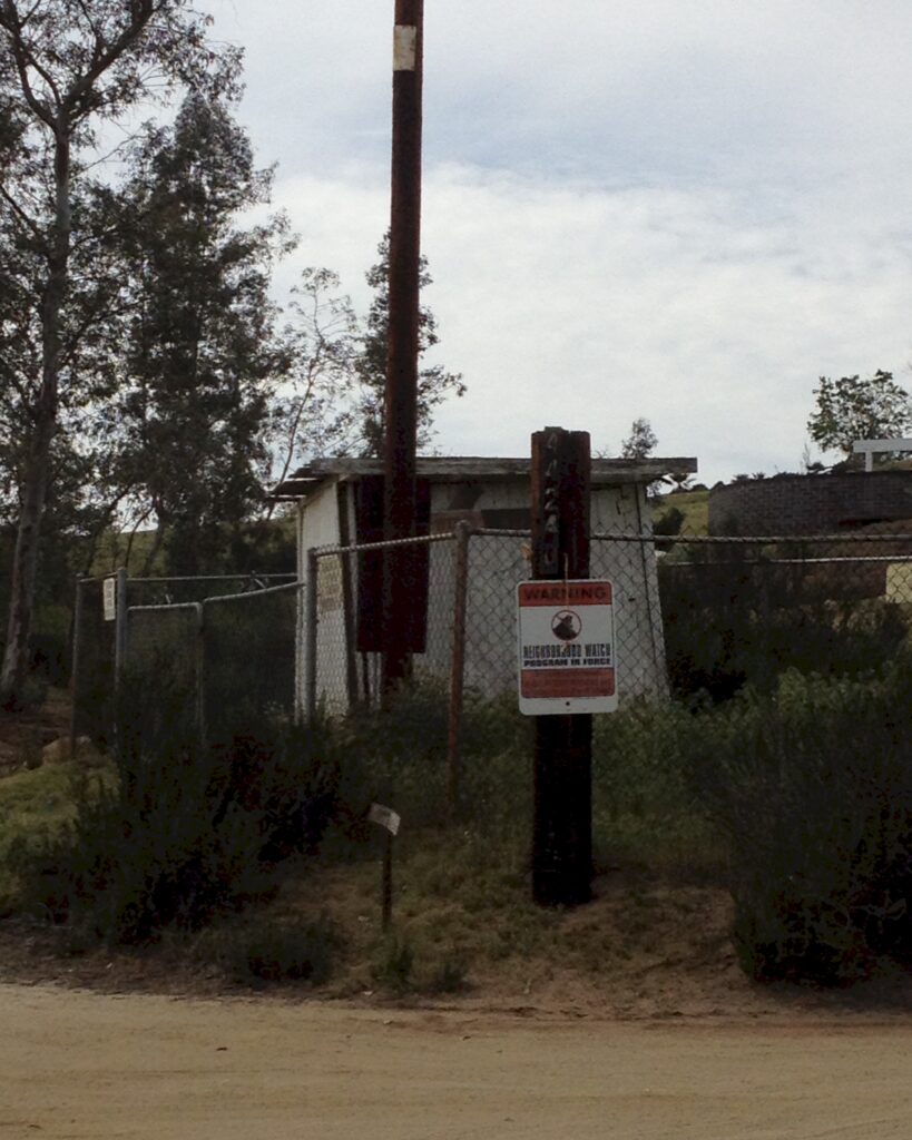
This next photo is showing 44240 the commonly known street address. However, the 1968 Record of Survey book 53 page 40 would likely idntify that well house sits on parcel 4 RS 53/40. The January 1970 Riverside County official Assessor map 571-04 identifies the property in the photo as par4. The tax id is known as 571-040-004.
Make no mistake, 44350 and 44240 are both one of the same as in par4 and APN 571-040-004.
I ask that you do not submit to group think. Follow the facts then draw a conclusion. Recorded facts and photographed images don’t lie, people do.
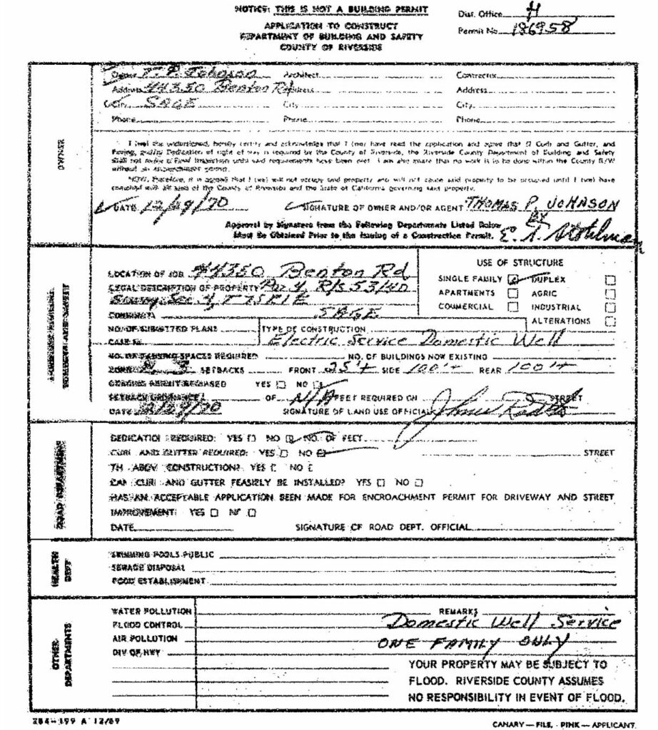
December 29, 1970 somebody other than the owner being Mr. Thomas Johnson attempted to get a building permit for an electrical service on his parcel located at 44350 Benton Rd. Riverside County archived records show Building and Safety permit #186958 was issued and then canceled. At the time of cancelation an electrical service panel was already install and connected to Southern Cal Edison energy grid as it remains today.
Look to the bottom right on that application below, clearly written by hand it stated, “Domestic well service one family only“. The grandfather clause need be applied.
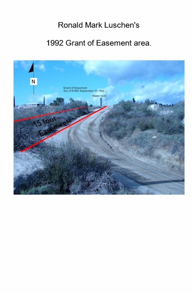
This next picture is of the 1968 records of survey R/S 53/40. Par4 is where that permit 186958 was issued for use. Unpermitted and uninspected by County Officials approximately 800 + or – ft. of electrical cables runs hidden under earth from the red dot to the blue dot. That 240 volt energy source is a Building and Safety hazard that remains in violation of County Building Ordinances. The energy source is currently running two wells on two seperatly owned parcels. That yellow lot represents Reeds Well located on RS 53/40 par 2 and the lot with a red dot is Haddens Well at 44240 East Benton AKA 44350 East Benton APN 571-040-004 RS 53/40 par4.
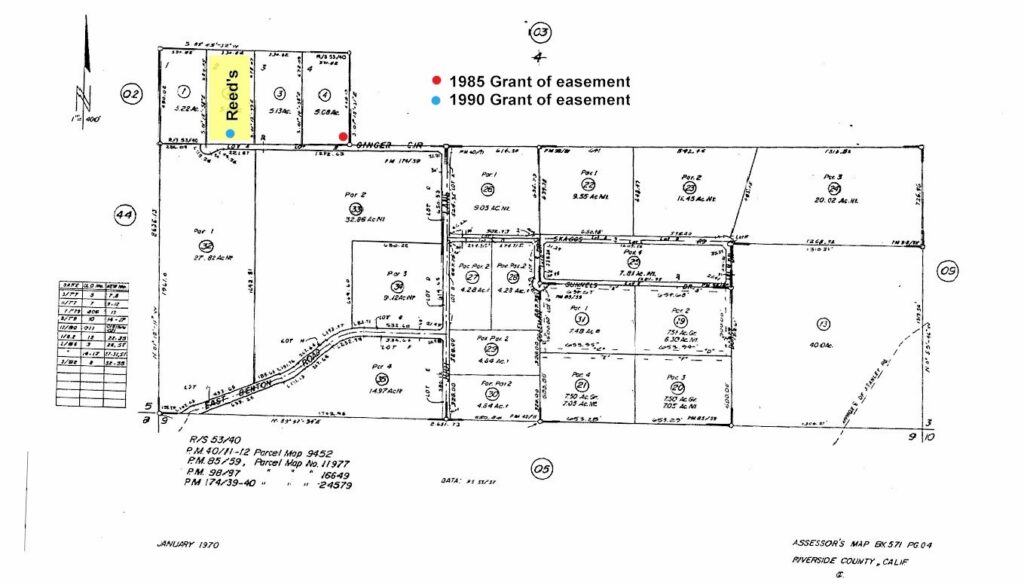
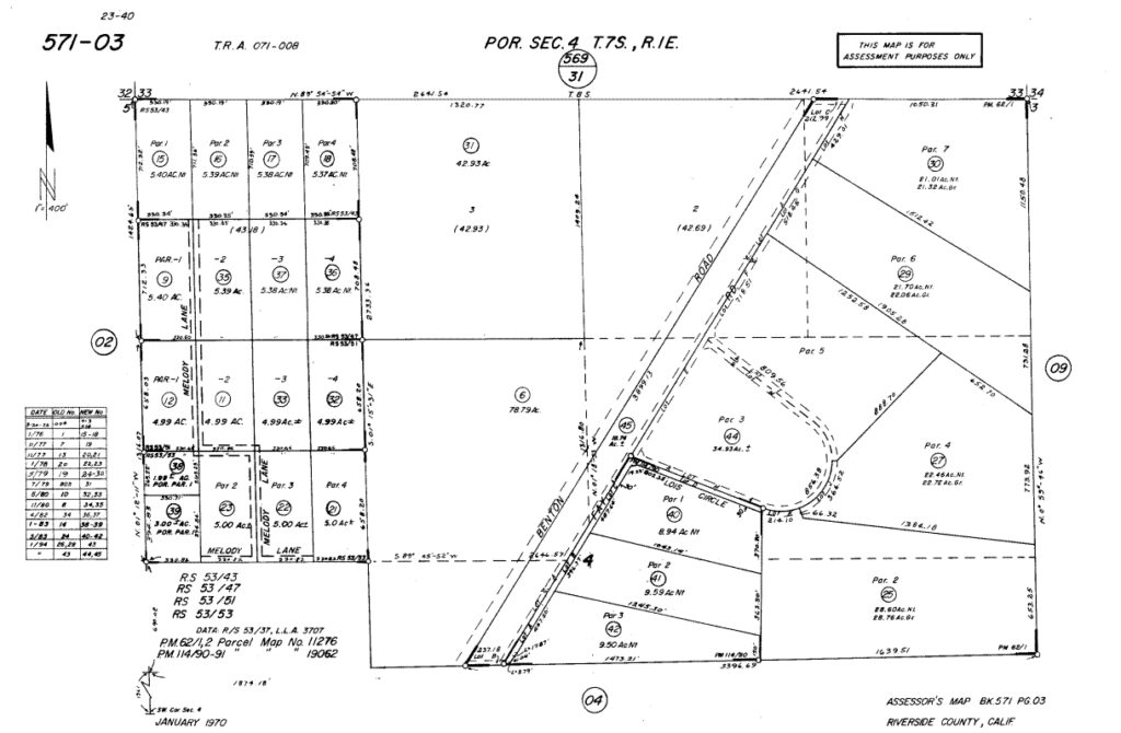
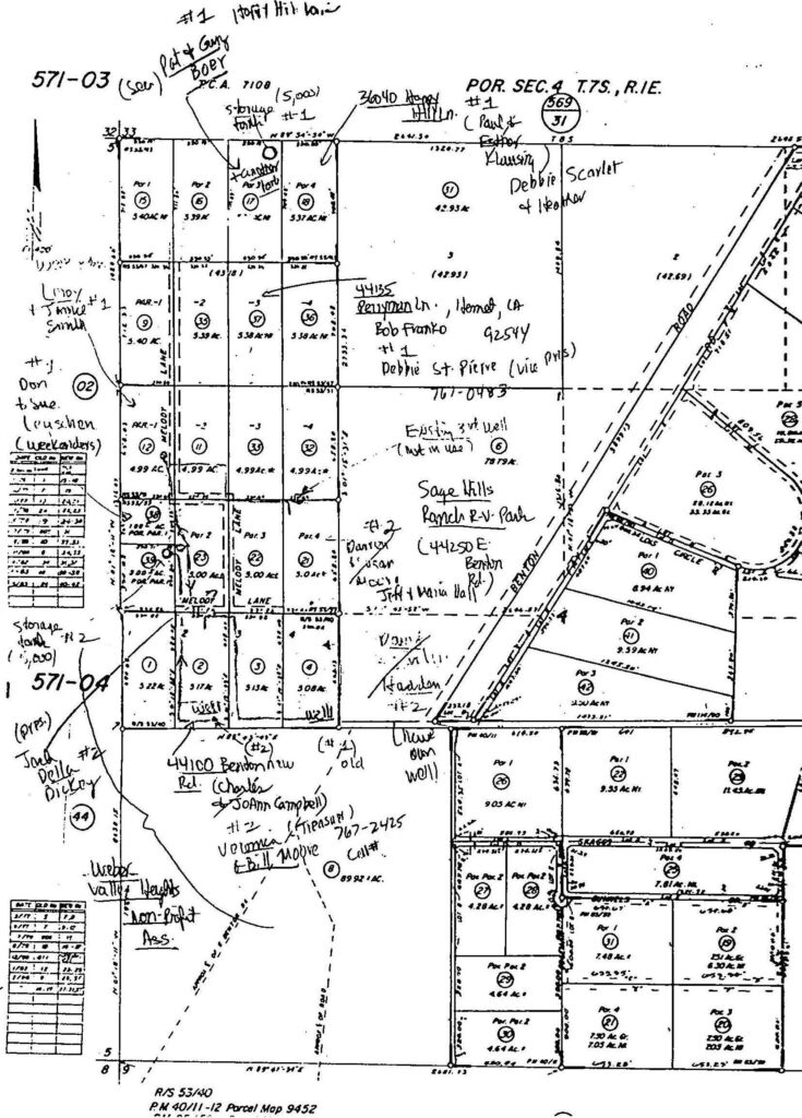
In the dated order of recordings at the bottom is record of Survey in book 53 page 40 as shown on the bottom as four parcels. The record of survey was created by recording the map on December 20, 1968 by Thomas Johnson. For clairity the above photo depicts a portion of the west 1/2 of the west 1/2 of Township 7 Section 4. At the bottom is R/S 53/40 par1, par2, par3 and par4. Moving to the rop portion of the pic is R/S 53/43 par1, par2, par3 and par4. Right be low that R/S 53/43 is R/S 53/47 par1, par2, par3 and par4. and below that is RS 53/47 par1, par2, par3 and par4. Next is R/S 53/51 par1, par2, par3 and par4. Finally R/S 53/53 par1, par2, par3 and par4. All of the R/S records are from west to east 1, 2, 3, and 4.